‘This entire area used to be the sea’: how Kenya’s port expansion is transforming the ocean floor
Chemtai Kirui in Lamu, Kenya
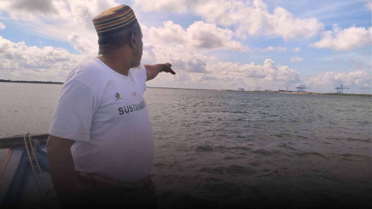
The tide was calm as a small wooden fishing boat carrying Abubakar Mohammed Twalib crossed Manda Bay, off the northern coast.
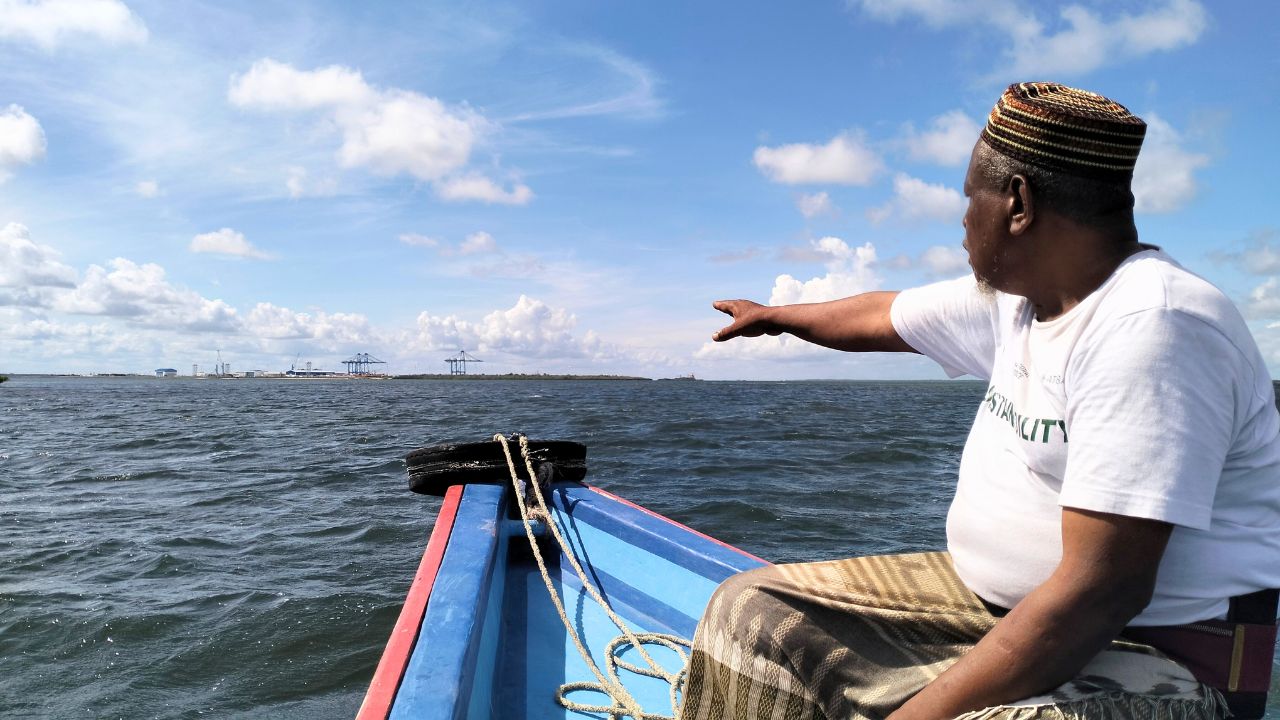
Standing on the edge of the boat, Twalib, a fisherman who has worked these waters for years and chairs the Amu Beach Management Unit, raised his right hand towards the mainland shore, tracing the coastline that had once been there.
“All of this you see,” he said, “used to be the sea.”
Twalib’s hand moved in a slow arc, pointing to the area where, he said, mangrove forests once stood.
“They cut down the mangroves,” he said. “Then they started dredging… They filled it with sand until the sea disappeared.”
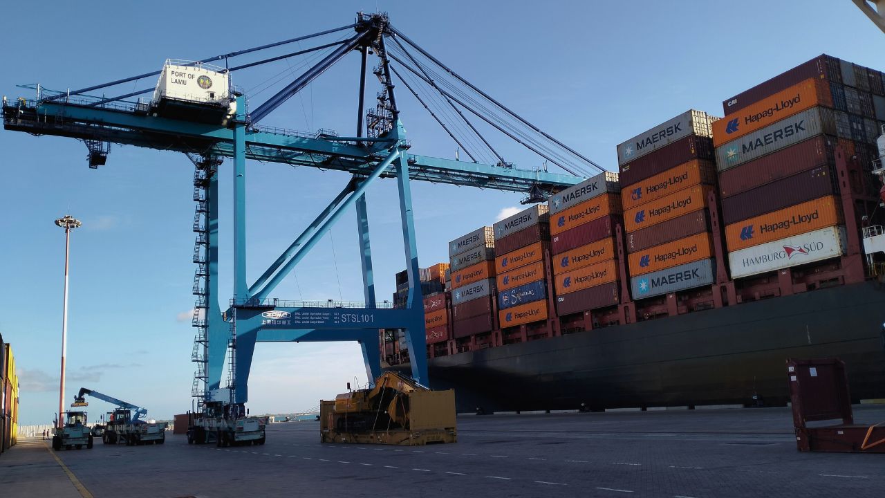
Across the bay, towering blue container cranes rise above a ruler-straight concrete quay built over what was once open water. Navigation buoys mark a shipping channel, while cargo vessels carrying motor vehicles, fertiliser, livestock, machinery and other goods berth at the terminal.
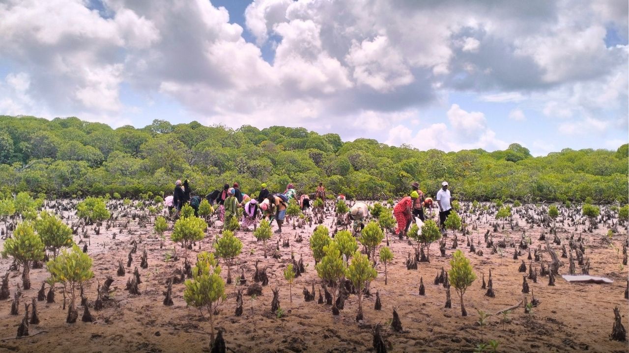
Along parts of the shoreline, scattered mangrove stumps protrude from the mud where dense mangrove forests once stood.
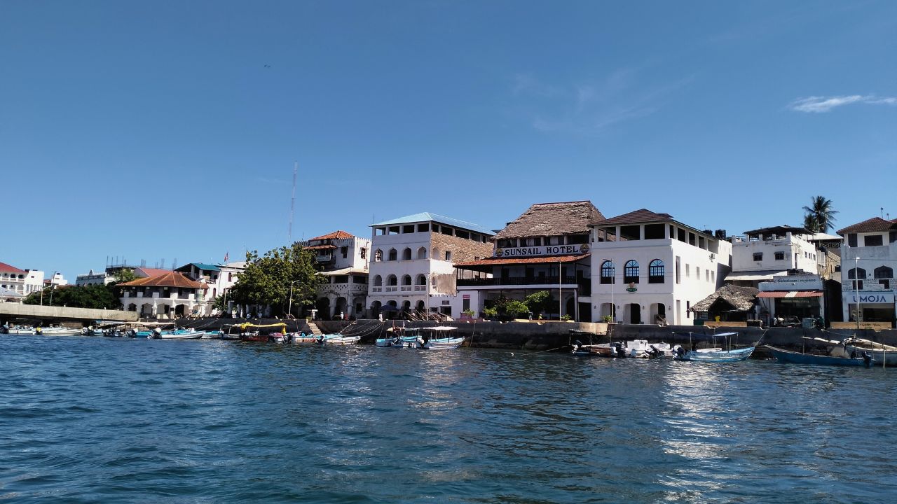
Lamu county lies on Kenya’s northern coast, close to the border with Somalia. Its Old Town, one of the oldest and best-preserved Swahili settlements in East Africa, is a Unesco World Heritage site.
Beyond the narrow streets and carved wooden doors of the old town lies a far larger coastal ecosystem. Lamu contains Kenya’s largest area of mangrove forest, extensive seagrass beds and coral reefs that support fish, turtles and dugongs – large marine mammals that graze on seagrass.
Much of this ecosystem is spread across the channels, bays and islands of the Lamu archipelago. Among them is Manda Bay, the broad stretch of water between the mainland and the islands of Manda and Pate, where mangrove-fringed shores, shallow seagrass meadows and coral habitats meet.
But the same geography that made the area ecologically rich also made it attractive to planners. Manda Bay’s natural deep-water conditions allowed for the navigation of large vessels and provided scope for the expansion of a major port, according to the Lamu Port-South Sudan-Ethiopia Transport Corridor (LAPSSET) Strategic Environmental Assessment.
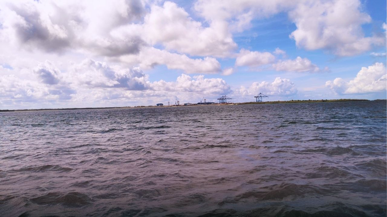
Large ships, however, still needed a navigable route into the terminal and room to turn. At Kililana, on the mainland shore opposite Lamu Island, that meant dredging the seabed along the approach channel and turning basin, reclaiming part of the bay for the terminal and building three 400-metre berths.
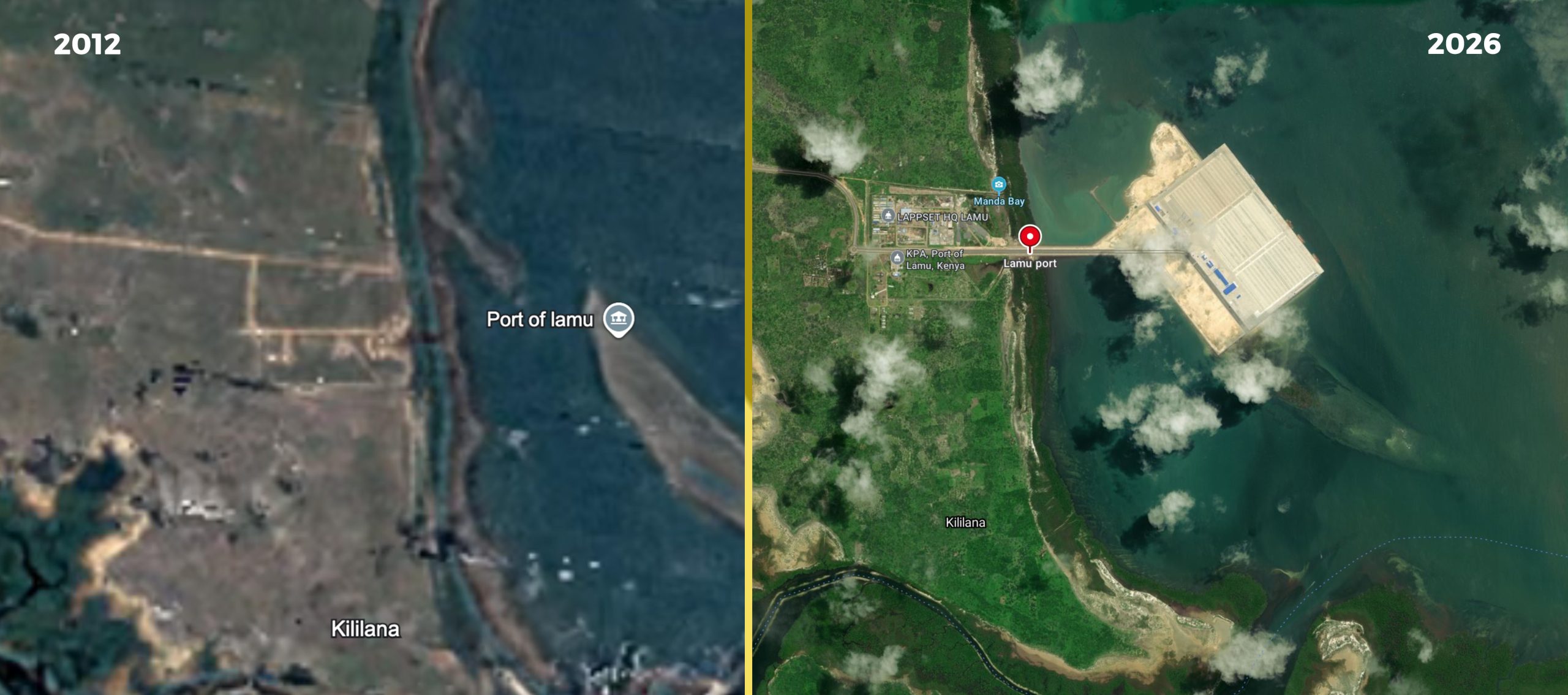
The first three berths are now operational. Kenya Ports Authority’s current plan provides for 23 berths along about 10km of shoreline.
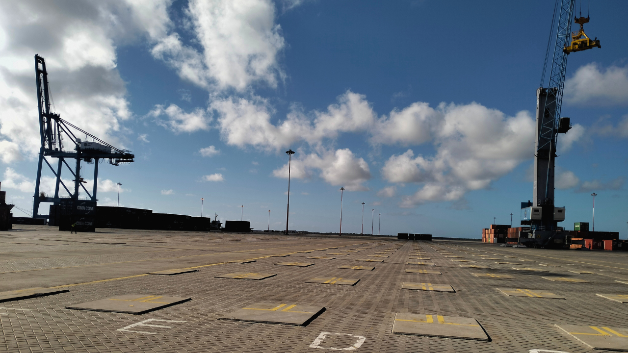
Research by geographer Gediminas Lesutis found that construction of the first three berths covered about five square kilometres of Manda Bay. Land reclamation and dredging destroyed coral reefs and mangroves that served as fish breeding grounds, while dredging brought up dirt and sand that polluted breeding grounds in the remaining bay.
Lesutis found that the Manda Channel, sheltered from the stronger winds and waves of the Indian Ocean, was a principal fishing area during the rainy season. The changes have affected waters that islanders had long relied on.
A coastline shaped by centuries
Manda Bay has long been part of the life of the coast. At Manda Town, an early Swahili settlement on Manda Island, archaeologist Neville Chittick found evidence of occupation dating to the 8th and 9th centuries. Later research has offered clues to how early Swahili communities lived from the sea.
A study published in Internet Archaeology used fish remains from settlements in the Lamu Archipelago to identify the marine habitats people relied on, including coral reefs, estuaries and mangroves.
Before construction of the port, fishing remained woven into the shallow waters around the Lamu archipelago. Fishers worked from wooden boats, using seine nets, handlines, gillnets and spears. Some dived with harpoons for high-value lobsters; others targeted reef-associated fish such as emperors and tuna.
The fishing grounds were closely tied to the habitats around them. A participatory mapping study of Lamu’s coastal communities found that fishers frequented coral reefs, mangroves and open waters across the archipelago for the fish these ecosystems supported, with many of the mapped grounds lying within 10km of the port site.
For communities dependent on those nearshore waters, the changes have been tangible. A 2026 study of 380 households in Lamu County found that respondents rated fish size, catch quantity, species variety and access to fishing grounds highly before construction. After the first three berths were completed, they reported marked declines in each.
Making way for the ships
“The key to any port is the route,” says Simon Komu Mulwa, a former Lamu County fisheries chief officer and county director for fisheries. For ships of a particular size to reach the port, he says, the approach channel has to meet specific depth and navigational requirements.
Dredging to create that route disturbed marine habitats in Manda Bay, he says.
“Where there is dredging, there are impacts,” Mulwa says. “There was destruction of very delicate habitats.”
For Abdulkarim Badawy, who has worked on Manda Bay for 18 years, the changes have altered the waters he has long depended on.
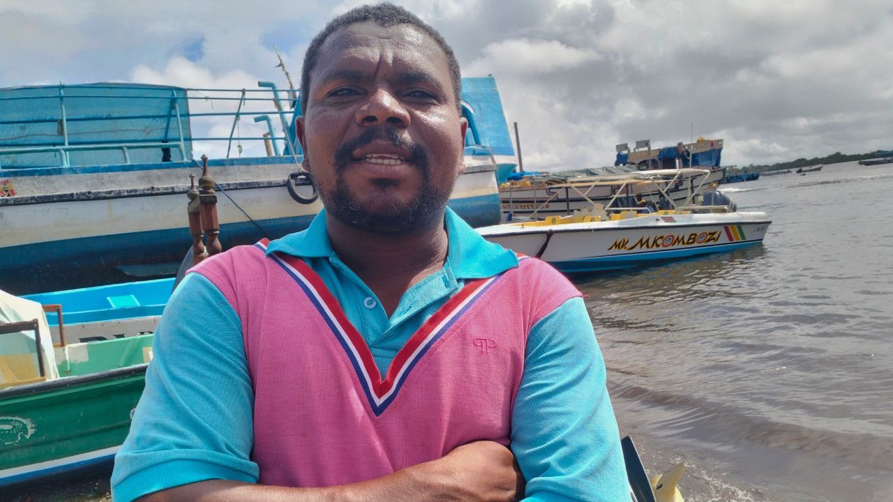
Large commercial vessels now share channels once used mainly by fishing and passenger boats, forcing smaller boats to give way.
“Our problem is that port,” he says. “When it came, it disrupted our activities and forced us to give way to ships because the vessels are huge. We are the small ones. We must clear the way for the larger ones.”
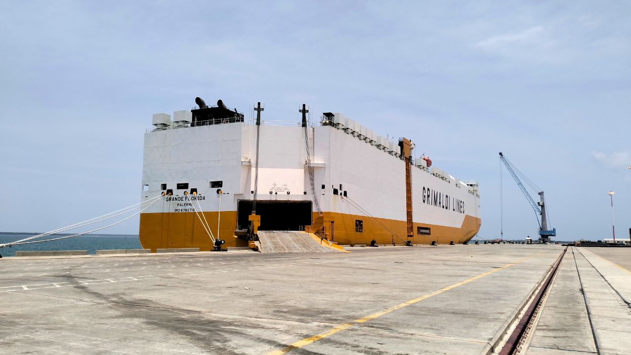
Parts of the bay are now governed by the navigational and security requirements of a commercial port. Fishermen and boat operators have to navigate around port traffic and contend with KPA security personnel and Kenya Coast Guard officers enforcing exclusion zones around berths and navigation channels, Twalib says.
Twalib also takes visitors out on the bay. He says a snorkeling site that once attracted tourists is now harder to use because the water has become too murky for visitors to see the fish below.
“Back then, looking at the water here, it looked like glass,” he says. Today, visitors struggle to see fish beneath the surface.
“If the water down there is murky and they see nothing, the tourist refuses to pay,” Twalib says.
Swabir Zein Ahmed, a captain with Lamu Boat Operators, says dredging has made some routes more difficult to navigate.
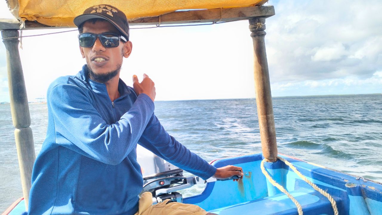
“Sometimes we are forced to cancel trips because we cannot pass,” he says. “We cannot risk our lives.”
The fight before the port
When plans for the port were first announced, Mama Raya Faraj Famau was among the activists who challenged them.
Famau, executive director of Lamu Women Alliance, became involved after learning that residents in Kililana were being displaced as land was acquired for the port and associated infrastructure.

The families said they had occupied and farmed the land for generations, but many lacked individual title deeds. The government classified the land as public, while residents maintained that it was ancestral land – a dispute that complicated claims for compensation.
“We were not opposing development,” Famau says. “We wanted the government to follow the environmental laws and involve the community.”
In 2012, residents went to court, arguing that the government had failed to properly assess the project’s environmental, economic and cultural costs and had not adequately consulted affected communities.
The case identified 4,734 local fishermen whose livelihoods could be affected.
“We said the fisherman would lose his daily livelihood,” says Somo M. Somo, chairperson of Lamu’s Beach Management Units. “We also said the environment of Lamu County would be destroyed.”
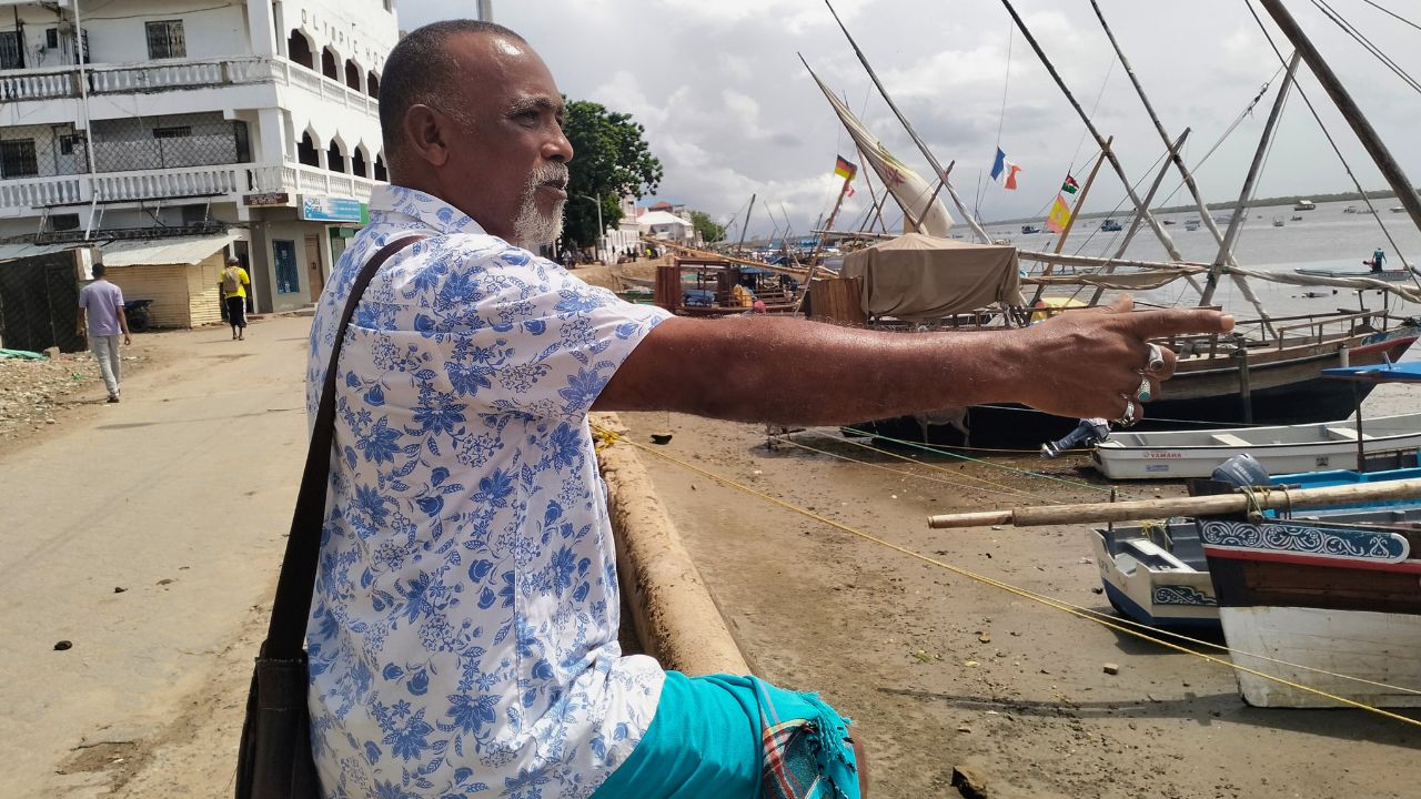
The case was led by Mohamed Ali Baadi, a retired teacher and community organiser who became the public face of the challenge. The petitioners did not oppose the project itself, the court later noted, but challenged the way it was being implemented and the environmental, economic and cultural costs they said had not been properly considered.
In 2018, the High Court found that the project had proceeded without the Strategic Environmental Assessment required before its individual components were implemented. It also found failures in public participation, compliance with the environmental licence and mitigation of environmental impacts.
The court ordered KSh1.76bn in compensation for affected fishermen and directed authorities and the project proponents to strengthen environmental safeguards, monitoring and coordination with Lamu County.
But Mohamed Athman, secretary general of Save Lamu, a community coalition that has campaigned for environmental and social justice in Lamu, says the judgment has not been fully implemented.
“Winning a case is one thing; implementing what you won in a case is another,” he says.
Today, the community still lacks detailed information about the port, Athman says, including employment and access, while environmental monitoring remains opaque.
“Projects are happening. No feedback. We don’t know what is going well, what is a challenge,” Athman says.
For Somo, the case was never only about compensation.
“Whatever you do, you must first agree with the community. You cannot just do things secretly,” he says.
“Where you used to catch 200 kilos or 300 kilos in a few hours, now you fish all night and may not even reach 50 kilos.”
A 2026 study published in the Western Indian Ocean Journal of Marine Science found that fish productivity was the livelihood indicator most affected by Lamu Port development, with respondents reporting smaller catches and fewer fish species.
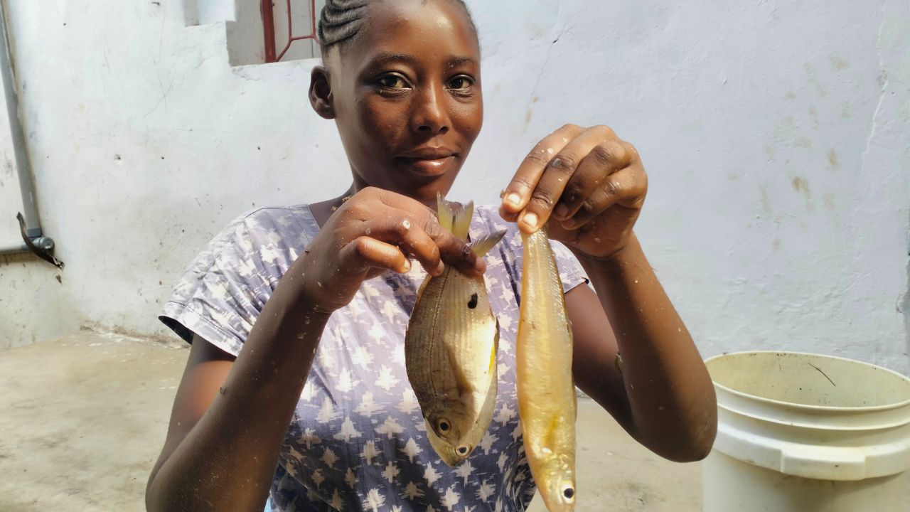
For fish vendors, the effects are felt in the price of what reaches the market. Sharon Kasiwa, a fish vendor in Lamu, says a fish that once cost her about KSh100 now costs around KSh300.
“Things have changed since Lamu Port was built,” she says. “Fish now come from further away.”
The compensation had two components. In a 2024 parliamentary response, the government said 65% was to be paid as cash compensation, while the remaining 35%, worth KSh640m, was set aside for physical infrastructure and support services for the fishing industry. KPA was to consult Lamu stakeholders on how that component should be used.
“The money was divided into two parts,” Somo says. “There was the cash transfer and the sustainable development fund. Most people received the cash, but the remaining 35% is still being discussed.”
Baadi died in December 2018, eight months after the ruling and before he could see its orders carried out.
What dredging can change
The dispute also raised questions about what could be lost beyond the fishing grounds themselves.
In the shallow seagrass meadows around Manda Bay, Somo says, dugongs once surfaced regularly. Today, he says, people struggle to remember the last time they saw one.
Compensation can replace income already lost, Somo added. It cannot restore a damaged fishery.
The questions raised by Lamu’s port have surfaced elsewhere along Kenya’s coast. About 270km south, in Kwale, residents challenged offshore marine-sand harvesting linked to the expansion of Mombasa’s port.
The harvesting, which affected waters off the South Coast, drew opposition from residents, fishers and tourism interests, who warned that removing sand from the seabed could disturb coastal processes and marine habitats.
George Mokaya, chairman of the South Coast Residents Association, remembers people asking what would happen if the sand that replenishes beaches was taken away.
“It’s like you’re cutting a left arm to strengthen the right arm,” he says.
During the court challenge, marine experts argued this point, saying that the effects of the port could not be contained to the areas marked for construction. Sediment released by dredging could move through the bay, altering water quality, coastal processes and habitats beyond the immediate work sites.
But dredging itself is not necessarily destructive, says Joseph Nyingi Kamau, assistant director for oceanography and hydrography at the Kenya Marine and Fisheries Research Institute (KMFRI).
“There is nothing wrong with dredging,” he says. “If you want a port, you have to dredge. It’s how you do it that matters.”
Before dredging begins, scientists establish an environmental baseline: mapping coral reefs, seagrass meadows, fisheries and seabed conditions, while modelling where sediment could travel once it enters the water.
“There are two components,” Kamau says. “There is the actual dredging and there is the disposal of the dredged material.”
Every project, he says, begins with a different coastline.
“There are not two systems that are alike. You need to understand the baseline first.”
For David Obura, director of Coastal Oceans Research and Development – Indian Ocean (CORDIO) East Africa and chair of the Intergovernmental Platform on Biodiversity and Ecosystem Services (IPBES), the greater difficulty comes after those individual assessments: understanding what happens when projects accumulate across connected marine ecosystems.
An “integrated common system” is needed, he says, to bring information from different projects together and track changes over time.
The problem, Obura says, is not necessarily a lack of data but the difficulty of connecting information collected for individual projects into a longer-term picture of a connected coastal ecosystem.
Some methods are carried forward between projects, Obura says, but links between datasets are often weak. Long-term follow-up and public transparency also remain limited.
The result, he says, is that damage can accumulate long before it becomes fully understood.
Suspended sediment can turn normally clear coastal waters cloudy brown, reducing the sunlight that seagrasses and corals depend on. When concentrations become high enough, entire ecosystems can be buried beneath fine particles.
Obura points to Mombasa’s Tudor and Port Reitz creeks, where sediment mobilised during dredging has been carried towards Nyali Reef. At lower concentrations, he says, the damage can be harder to detect. More sensitive corals can disappear first, leaving behind simpler reefs with fewer species and less structural complexity, making them less able to recover from further disturbance.
After the dredgers leave
Kenya has a formal system for monitoring environmental compliance. For Lamu Port, the environmental licence required an audit during the first year of occupation, operations or commissioning to assess the effectiveness of its environmental management plan.
The system had already been tested in court.
In 2018, the High Court found that the project proponents had failed to comply with a licence condition requiring a detailed Environmental Management and Monitoring Plan.
That did not mean that no monitoring was taking place. During the court case, project representatives said monthly environmental monitoring reports were being produced, and copies were presented to the court. The court did not question the authenticity of the reports. Its concern was what those reports could show without the baseline data, indicators and monitoring framework required by the licence.
The court remanded the licence to NEMA for reconsideration and required the project proponent to prepare a detailed monitoring plan. It also found that the wider LAPSSET project should have undergone a Strategic Environmental Assessment and that the environmental and social costs of the first three berths and the wider corridor had not been adequately assessed.
Three years later, a December 2021 environmental and social audit of the first three berths found some of the same problems. The audit said the port’s environmental management plan still lacked a detailed monitoring framework and that marine water-quality data from the dredging were not available to the auditors.
It also recorded reports of coral damage and found no evidence that coral translocation had taken place or that proposed mitigation measures had worked.
A programme to restore degraded coral reefs and seagrass beds had not been developed or implemented at the time of the audit.
A 2022 study of the project’s environmental and social safeguards reported similar concerns, including a lack of water-quality monitoring and failure to deploy silt curtains required under the environmental safeguards.
There was, in other words, a paper trail of monitoring. But it is not clear whether the concerns raised in the 2021 audit were ever addressed.
KPA publishes environmental monitoring records for some of its other port projects. But an equivalent publicly accessible run of environmental audits, compliance findings and marine monitoring reports for Lamu Port could not be found.
That does not establish that the measures were never implemented or that monitoring stopped. It means the public record becomes difficult to follow.
Edward Menza, the Lamu county director for the National Environment Management Authority (NEMA), says monitoring at the port is continuing.
Menza says the system includes annual environmental audits, licence conditions and a coral reef and seagrass management plan that is being developed. KPA submits its annual audits to NEMA, he says, while KMFRI continues to monitor marine habitats around the port.
“The work is ongoing,” Menza says. “Whenever there are issues requiring government action, the agencies come together.”
Sabrina Jefwa Mkare, Lamu’s county executive committee member for fisheries and the blue economy, says the county is taking part in mangrove restoration and capacity-building with community groups and other agencies.
She says responsibilities arising from the ruling were assigned to KPA rather than the county government.
“The ruling did not put these tasks on the county government,” she says. “I don’t think the responsibility was entirely with the county to do the monitoring and evaluation.”
KPA was contacted for this story and given an opportunity to provide its monitoring records and respond to questions about environmental monitoring, cumulative impacts and the implementation of the court’s requirements. On 11 August, KPA communications officer Aaron Mutiso acknowledged receipt and said the authority was preparing a response. No further response was received.
NEMA was asked to provide records of its compliance inspections, environmental audits, monitoring requirements and corrective measures, including what followed the problems identified during construction. No response or documents were received by the time of publication.
Monitoring, Menza says, is continuing. But the records needed to show what it has found were not made available for this story.
For Twalib, a fisherman and chair of the Amu Beach Management Unit, the changes are visible from the water.
Even when the sea was rough, he says, fishing boats filled the water so densely that “you couldn’t see the horizon, you couldn’t see the sea – you would only see fishermen and their vessels.”
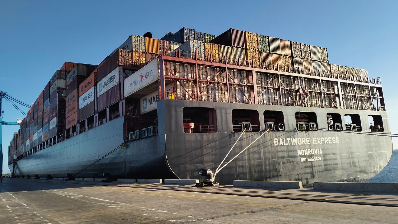
Today, the same waters form part of the approach to Lamu Port, where the first three berths can accommodate Panamax and post-Panamax ships. In recent months, the port has received container vessels, conventional cargo ships and large vehicle carriers, including the 369-metre MV Baltimore Express, which in May became the largest vessel ever to dock at a port in east and central Africa.
Twalib remembers a time when fishermen could move through these waters more freely, including when rough seas forced them to seek shelter.
After a long day on the bay, Twalib sits at the edge of the fishing boat and looks towards the port.
“When the port authorities stationed their security here, what were they supposed to be doing in these waters?” he asks. “Weren’t they supposed to be helping us?”
“Isn’t this port Kenyan?” he says. “Isn’t this fisherman a Kenyan?”
This story was produced with the support of Internews’ Earth Journalism Network
Watch the mini-documentary, This Used to Be the Sea. Video/Kass Digital